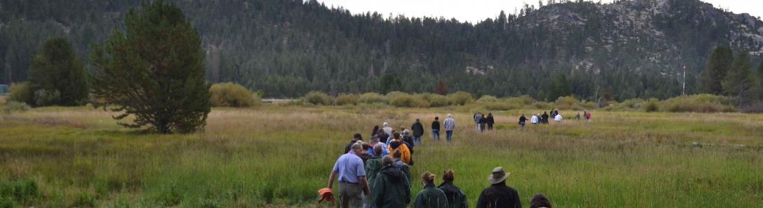
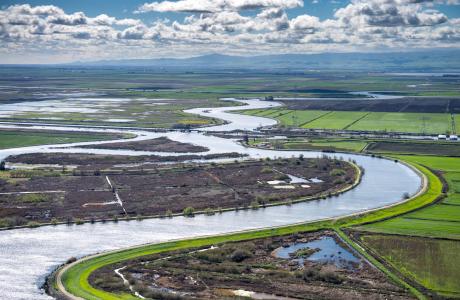
Watch our series of short videos on the importance of the
Sacramento-San Joaquin Delta, how it works as a water hub for
California and the challenges it is facing.
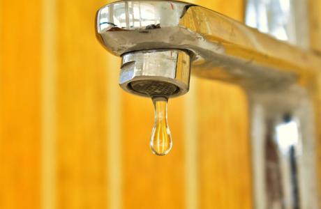
Some people in California and across the West struggle to access
safe, reliable and affordable water to meet their everyday needs
for drinking, cooking and sanitation.
There are many ways to support our nonprofit mission by donating
in someone’s honor or memory, becoming a regular contributor or
supporting specific projects.
As atmospheric rivers blasted across California this year, they
brought epic amounts of rain and snow follwing a three-year
drought.
Devastating and deadly floods hit parts of the state and now all
eyes are on the potential for more flooding, particularly in
the San Joaquin Valley as the record amount of snow in the
Sierras melts with warmer temperatures.
With anticipated sea level rise and other impacts of a changing
climate, flood management is increasingly critical in California.
Big
Day of Giving is nearly over but you still have
until midnight to support the Water Education Foundation’s tours,
workshops, publications and other programs with a donation to help us reach our
$15,000 fundraising goal - we are only
$6,405 away!
At the Foundation, we believe that education is as precious
as water. Your donations help us every day to teach K-12
educators how to bring water science into the classroom and to
empower future decision-makers through our professional
development programs.
Our portfolio of programs reach many people and in many
different ways:
Today is Big Day of Giving! Your donation will help
the Water Education Foundation continue its work to enhance
public understanding of our most precious natural resource
in in California and across the West – water.
Big Day of Giving is a 24-hour regional fundraising event that
has profound benefits for our educational programs and
publications on drought, floods, groundwater, and the importance
of headwaters in California and the Colorado River Basin.
Your tax-deductible donation of
any size helps support our tours, scholarships, teacher training
workshops, free access to our daily water newsfeed and more. You
have until midnight to help us reach our $15,000
fundraising goal!
President Biden on Thursday expanded San Gabriel Mountains
National Monument by nearly a third in an action that was
widely praised by the Indigenous leaders, politicians,
conservationists and community organizers who had long fought
for the enlargement of the protected natural area that serves
as the backyard of the Los Angeles Basin. … Stretching
from Santa Clarita to San Bernardino, the San Gabriel Mountains
watershed provides Los Angeles County with 70% of its open
space and roughly 30% of its water. The added protections
will help ensure equitable access to the San Gabriels’ cool
streams and rugged canyons while also preserving clean air and
water.
Winter-like weather will make a brief return to California this
weekend, with widespread snow in the Sierra Nevada. The
National Weather Service has issued winter weather advisories
for much of the Sierra, including Donner Pass, the Tahoe
Basin and Yosemite National Park. The spring snowmaker will add
fresh powder in some locations, boosting an already healthy
snowpack.
Tribes that use the Colorado River want a say in negotiations
that will reshape how the river’s water is shared. Eighteen of
those tribes signed on to a letter sent to the Bureau of
Reclamation, the federal agency that will finalize new rules
for managing the river after 2026, when the current guidelines
expire. In the memo, tribal leaders urge the federal government
to protect their access to water and uphold long-standing legal
responsibilities. … The tribes’ letter aims to make sure
that Indigenous people, who used the Colorado River before
white settlers ever occupied the Western U.S., are not
left behind as Reclamation considers those proposals. “If you
are not at the table, you are on the menu,” Jay Weiner, a water
lawyer for the Quechan Indian Tribe, said. Weiner, who helped
craft the letter, said it aims to answer the complicated
question: What do tribes want?
Governor Gavin Newsom, with the support of the Department of
Water Resources (DWR) and other state agencies, signed into
effect new developments for the California Water Plan which
details water conservation efforts for the next five
years. Newsom said that the state has invested $9 billion
in the last three years, and that “I want folks to know that we
are not just victims of fate, that we recognize the world we’re
living in.” Recognizing that California will be
operating with ten percent less water in 2040 than what is
currently available, Newsom said “We put out a hotter, drier
strategy” to offset the loss. This includes plans for improving
water security, desalinization plants, stormwater capture,
water recycling, and new strategies for large-scale
conveyance.
As the date of reckoning for excessive groundwater pumping in
Tulare County grows closer, lobbying by water managers and
growers has ramped up. The Friant Water Authority, desperate to
protect its newly rebuilt – yet still sinking –
Friant-Kern Canal, has beseeched the Water Resources Control
Board to get involved. Specifically, it has asked board members
to look into how the Eastern Tule Groundwater Sustainability
Agency (GSA) has, or has not, curbed over pumping that affects
the canal. Meanwhile, the Eastern Tule groundwater agency has
been doing a bit of its own lobbying. It recently hosted all
five members of the Water Board on three separate tours of the
region, including the canal. Because the tours were staggered,
there wasn’t a quorum of board members, which meant they
weren’t automatically open to the public.
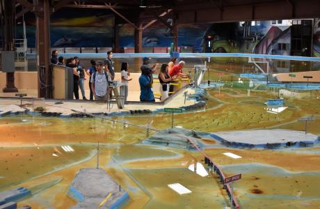
Operated by the U.S. Army Corps of Engineers, the
Bay Model is a giant hydraulic replica of San Francisco
Bay and the Sacramento-San Joaquin
Delta. It is housed in a converted World II-era
warehouse in Sausalito near San Francisco.
Hundreds of gallons of water are pumped through the
three-dimensional, 1.5-acre model to simulate a tidal ebb
and flow lasting 14 minutes.
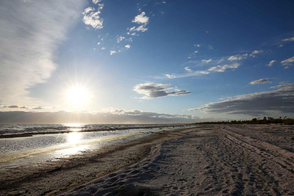
As part of the historic Colorado
River Delta, the Salton Sea regularly filled and dried for
thousands of years due to its elevation of 237 feet below
sea level.
The most recent version of the Salton Sea was formed in 1905 when
the Colorado River broke
through a series of dikes and flooded the seabed for two years,
creating California’s largest inland body of water. The
Salton Sea, which is saltier than the Pacific Ocean, includes 130
miles of shoreline and is larger than Lake Tahoe.